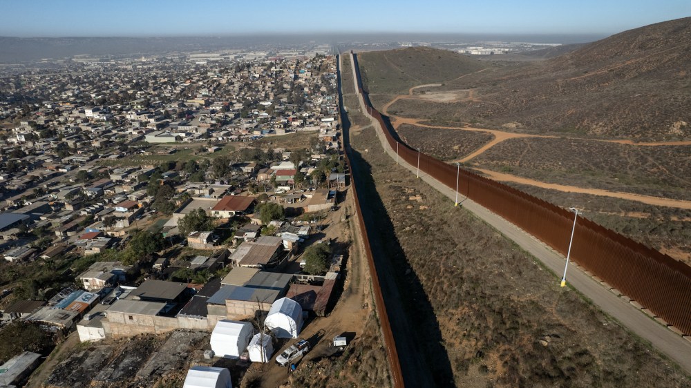
- The Trump administration directed military intelligence agencies to use satellite surveillance to monitor the U.S.-Mexico border. The initiative utilizes artificial intelligence, drones and satellite imagery to detect movement and track border crossings.
- The effort aligns with Trump’s campaign promise to strengthen border security and curb illegal immigration.
- Defense contractors, including Palantir and Anduril, supply technology integrating sensors, satellite feeds and surveillance data.
Full Story
The Trump administration directed two U.S. military intelligence agencies to use satellite surveillance to monitor the U.S.-Mexico border. The National Geospatial-Intelligence Agency and the National Reconnaissance Office, both part of the Department of Defense, began deploying resources in response to executive orders focused on curbing illegal immigration and dismantling drug cartels.
The NGA confirmed it created a task force to support the border mission. The NRO said it coordinated efforts with the broader intelligence community and the Pentagon. Officials have not confirmed whether the surveillance includes U.S. territory or focuses solely on foreign soil.
How does this fit into Trump’s broader immigration policy?
Trump’s directive aligns with his long-standing campaign promise to strengthen border security. After taking office, his administration increased troop deployments to the southern border, declared a national emergency, and examined the possibility of designating drug cartels as foreign terrorist organizations.
U.S. intelligence officials elevated transnational criminal networks in their national threat assessments. These concerns led the National Security Council to allocate more resources and receive daily briefings on immigration enforcement, including data on unaccompanied minors.
What technologies are being used to monitor the border?
The government has expanded its use of artificial intelligence and drones at the border. Under the current effort, officials aim to scale up those capabilities.
Sources familiar with the initiative said the AI systems analyze satellite imagery and video to detect movement across difficult terrain, similar to how the military conducts battlefield surveillance.
Defense contractors play a growing role in the effort. Companies such as Palantir and Anduril supply technology that integrates sensors, satellite feeds, and surveillance data.
Palantir’s Maven system, developed for the Pentagon, uses AI to streamline intelligence collection and target identification. Anduril has deployed 300 autonomous sensor towers that track movement with radar and other tools.
Is this a step toward a ‘digital wall’?
Officials involved in the initiative described a long-term goal to build a “digital wall” that complements the physical border barrier. The plan involves combining artificial intelligence, surveillance towers, and satellite imagery to detect and track border crossings in real time.
Sources said Palantir, Anduril, and SpaceX have discussed forming a consortium to bid jointly for U.S. defense contracts. The talks reflect an effort to challenge legacy contractors by offering agile, software-driven border security solutions.
Has Mexico responded to increased surveillance?
Mexican President Claudia Sheinbaum acknowledged the drone flights but downplayed their significance. She said the surveillance did not represent a new development and confirmed Mexico’s plan to request clarification through diplomatic channels.
Sheinbaum emphasized that the flights occurred over U.S. territory and said she does not expect the U.S. to take military action inside Mexico. As surveillance at the border expands, civil liberties advocates and legal analysts continue to press for transparency and oversight.